Waterton Townsite Pre/Post Wildfire Assessment & Zoning
Parks Canada – Waterton Lakes National Park
Waterton, AB, Canada
Project Requirements
- 2015 & 2016 – Complete avalanche hazard zoning for townsite of Waterton, BC, and Waterton Park headquarters offices and compound.
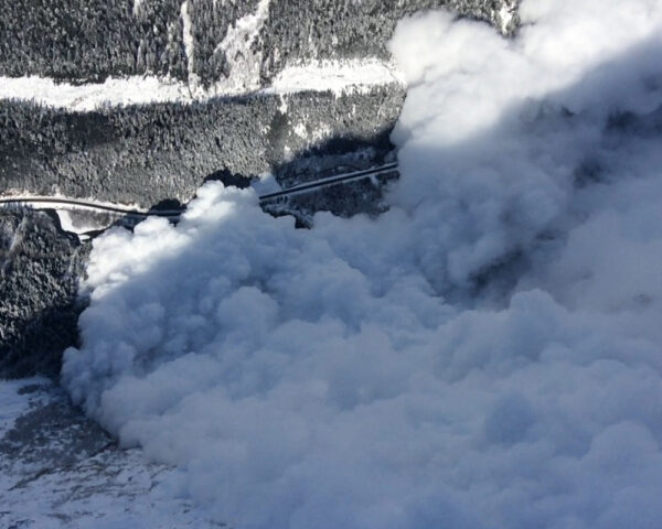
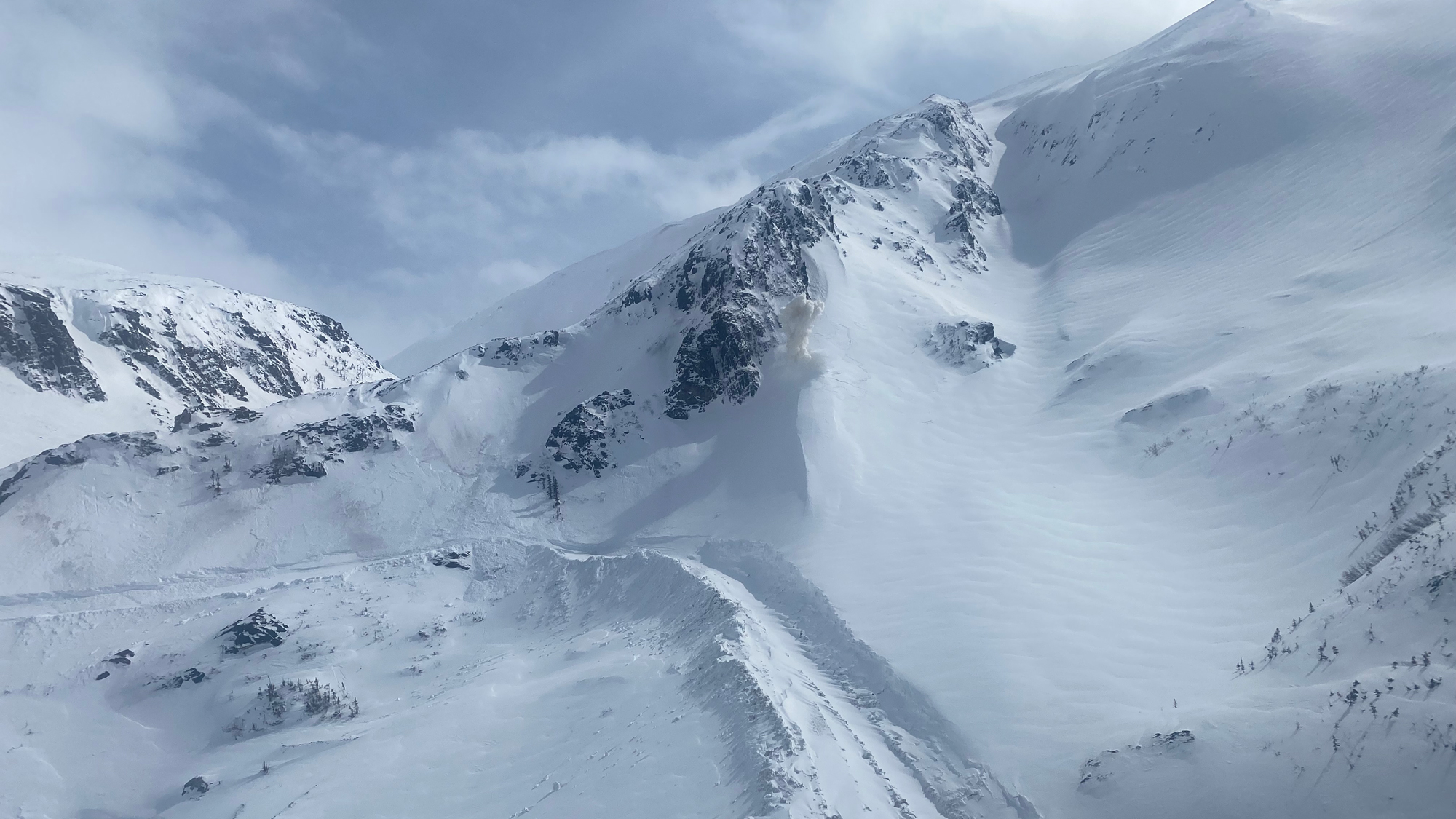
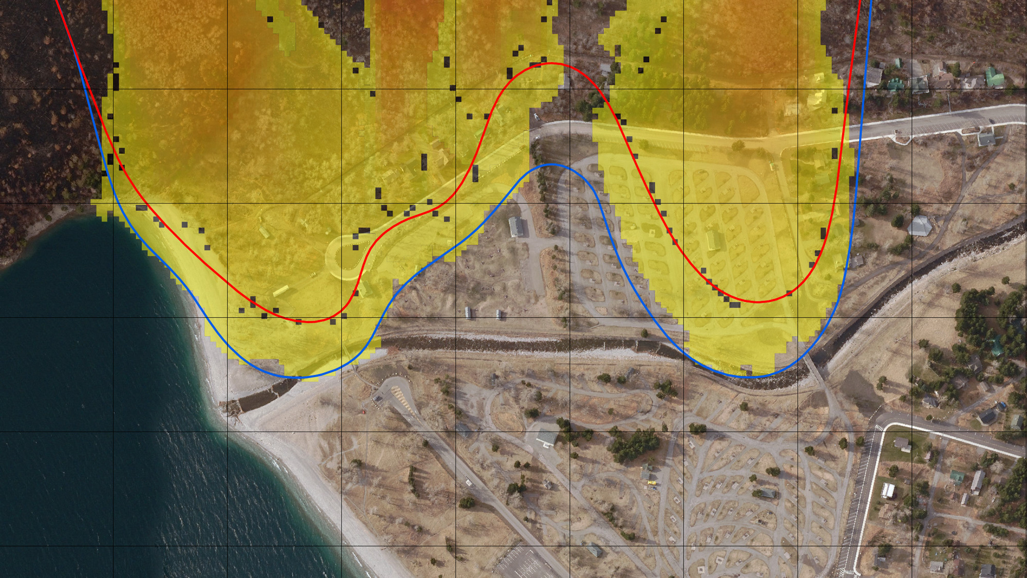
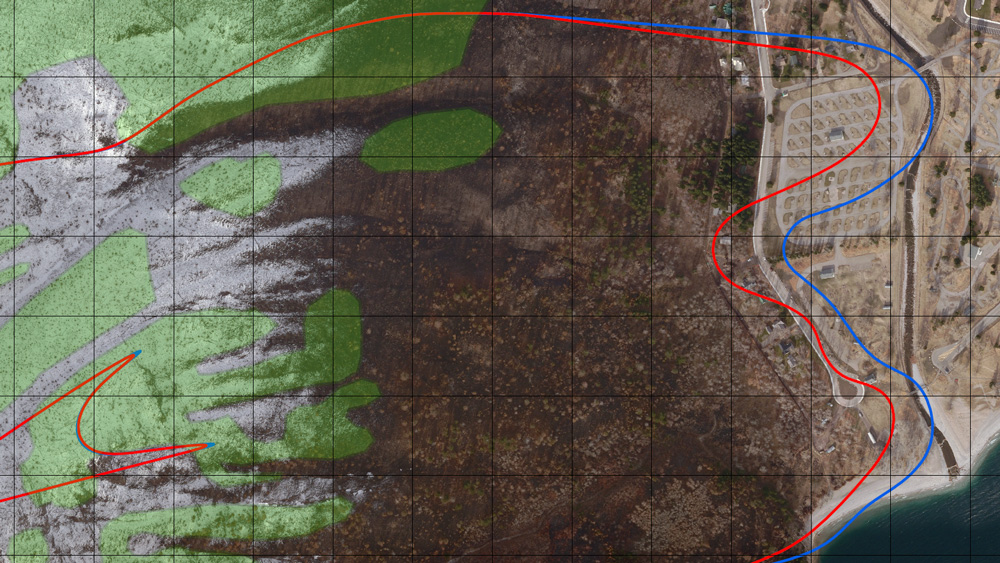
- 2017 – After devastating wildfire of September 2017, update avalanche hazard zoning maps for townsite and parks facilities. Further runout extent mapping for roads and campground facilities in the park.
Project Description
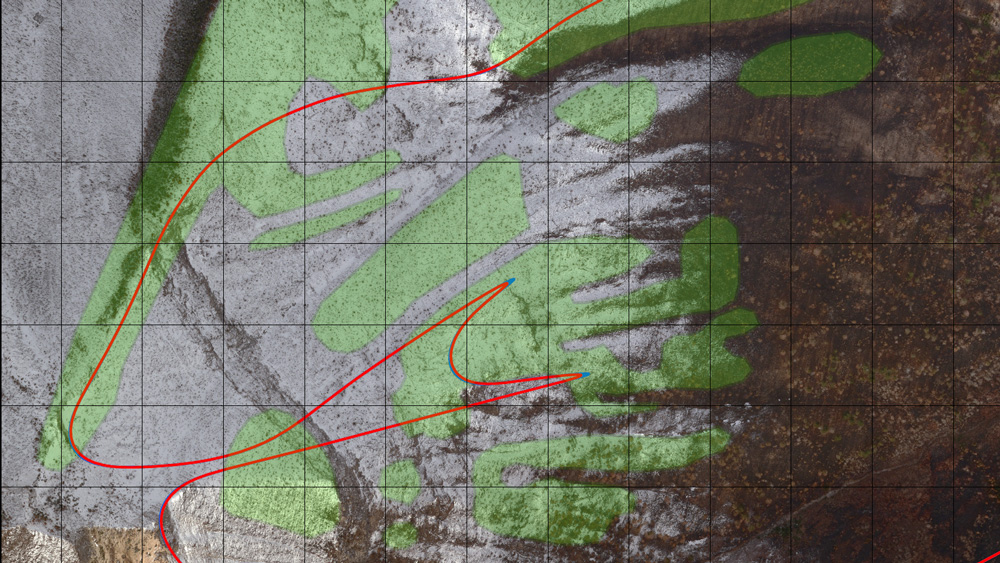
The Waterton townsite is located at the base of Bertha Mountain in Waterton Lakes National Park. Destructive avalanches have reached the townsite in the past century; however, there have been no significant avalanches since 1988 when an avalanche hazard study was commissioned by Parks Canada. The 1988 study resulted in the delineation of hazard lines and they have impacted land-use planning by creating zones of restricted occupation and further building development.
Due to revisions in avalanche zoning guidelines since 1988, as well as a longer observation period from which to draw on for analysis, Parks Canada commissioned Alpine Solutions to update hazard zone mapping in order to reduce uncertainty associated with development permit applications. Furthermore, wildfires during the summer of 2017 affected much of the avalanche terrain above the Waterton townsite, requiring a re-assessment of the avalanche hazard zones.
Challenges
- Determining the affect of forest cover on avalanche dynamics.
- Recommendations for mitigation and land-use restrictions that satisfies all stakeholder interests.
Solutions
- Modelling the pre- and post-wildfire scenarios using RAMMS forest cover parameters.
- Working with Parks Canada staff to develop realistic and appropriate mitigation strategies.
Related Projects